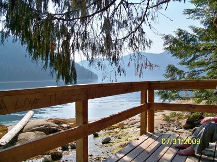
The Great Adventure
This
is the tale of an old man and his "bucket list" which included taking a
small boat up the "Inside Passage" to Alaska. It began as a
casual comment to my brother and ended up a year later with the two of
us admiring the spectacular beauty of Glacier Bay from the cockpit of
the "Last Hurrah".
I
should probably include a "don't try this at home" warning but suffice
it to say that we're both experienced boaters and we've lived long
enough (70's) to have used up most of our allotment of dumb decisions.
The
Last
Hurrah is a 26 ft. Glacier Bay power catamaran. She has a
closed
cabin (model 2690) with wide side decks, a kerosene heater/stove, a
microwave,
a very robust electrical system, dual station controls, substantial
ground
tackle and is rigged for easy handling of bow and stern lines from the
cockpit. In other words she’s an old fogie's boat.With her twin
150 hp Yamaha 4-strokes and a 180 gallon fuel capacity she has a range
of about 300 miles. Another valuable feature was her ability to
cruise comfortably in the mid 20's even in moderate chop.
This allowed us to take advantage of the early morning
"calm waters" and be at our destination before it got too sloppy.
For anyone thinking about heading up the Inside Passage to Alaska I
have to following Advice:
- It’s
an awesome adventure so don’t rush it. Leave enough time for weather
delays. Getting the snot knocked out of you at the start by trying to
cross Queen Charlotte Sound in bad weather can ruin your whole trip.
- Don’t scrimp on charts and cruising guides. They are a key safety factor
and they have lots of information that can make the trip much more interesting.
- While electronics are great and I wouldn’t go without
them they are computers and according to Murphy “whatever can go wrong will and
at the most inconvenient time”.
- If
you’re not proficient at coastal piloting (using charts, compass, etc. to
navigate) take a class.
- You
need at least a 200 mile range, substantial ground tackle and the ability to
hole up for 3 or 4 days with no services. We carried 2 anchors, both a
size larger than recommended for our boat, one with a 200 ft and the other a
300 ft anchor rode. The shores drop off very quickly and the tides can be
a large (25 ft). We also carried a 300 ft. stern tie which we’ve used in
the past cruising the BC coast but not on this trip.
- Be
prepared to operate safely in busy channels in dense fog. We had RADAR
with automatic target plotting, a receiver to pick up the Automatic
Identification System signals (AIS) broadcast by
the tugs, ferries and cruise ships, an automatic fog horn with listen-back and
the best RADAR reflector on the market. We used them all.
- Get
familiar with the locations referred to in the marine weather forecasts and
their significance. Some cruising guides and free marina guides have
charts showing these locations. For example, one of the keys to a
comfortable crossing of the infamous Queen Charlotte Sound is the “West Sea
Otter” ocean buoy. When the combined seas are 1 meter or less the
crossing is a piece of cake. For Last Hurrah it was OK at 1.6 meters but
no-go at 2 meters.
- Have
your routes plotted out in advance including hidey holes in case you’re caught
by bad weather. You’ll be cruising through a spectacular maze of
intersecting fjords that can look a lot alike from water level. There are
also lots of drying rocks to be avoided and tidal rips to negotiate.
Also, the entrances to some of the most strategic hidey holes can be
challenging and require careful advance planning.
- There are many neat places to visit that don’t have docks so have a
dinghy. Ours was nothing fancy.
- Always
maintain a "dead head" watch, especially in choppy waters because there
are lots of "dead heads" some big enough to cause serious daamage to a
small boat.
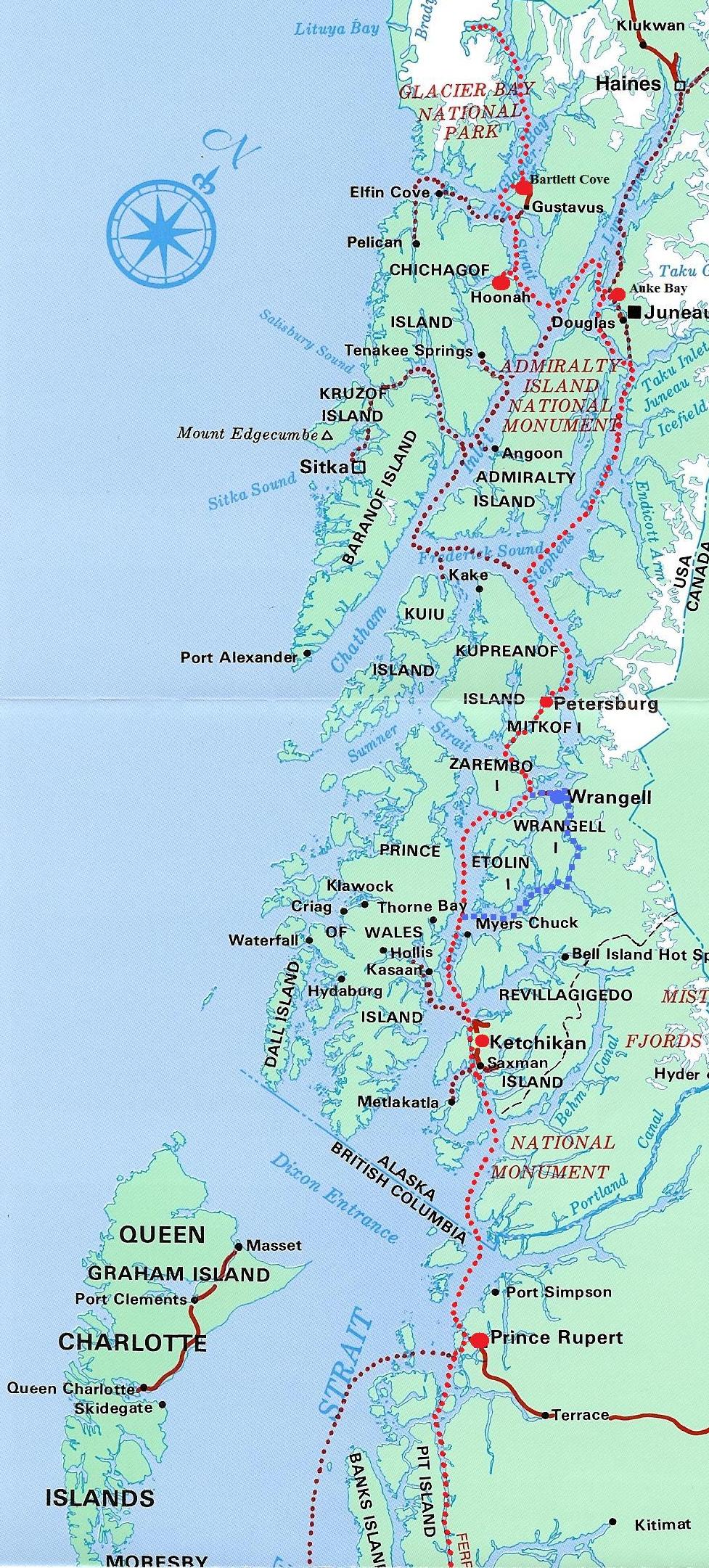
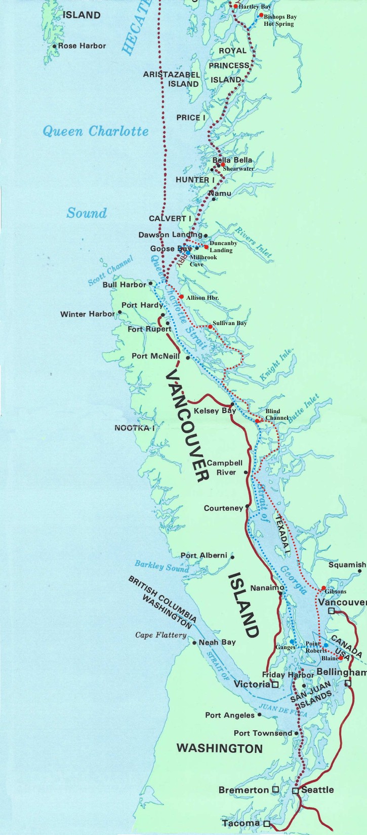
These
charts show the Inside Passage and our routes. The bright red
dotted line shows our main route both north and suthbound. The
large red and blue dots show where we stopped overnight. The blue dotted lines show where we deviated from our main route on our southbound trip.
Well, it's time for "the rest of the story".
What follows are excerpts from the Last Hurrah's log and selected
pictures. Some videos from this trip are posted on YouTube at Views of Alaska from a Small Boat. The trip north was with by brother Curt and his son Ken. My daughter Julie crewed for on the southbound trip.
Day 1, 6/28/09 - The drive
over the Cascade Mountains from Richland to Blaine, WA was uneventful. We
left about 7:30 and were in Blaine by 1:30. Beautiful day, not too hot
and with three drivers it was a breeze. Preparing the boat and launching
also went well. Curt stayed with the boat while Ken and I took the truck
and trailer to a mini-storage place. That was our first major
challenge. I had called the storage place the week before to reserve
space but when we arrived there was a note saying we were coming but no
“reserved” space. Ken walked the place with the lady-in-charge while I
waited in the truck and he picked the “best” of the available spaces. We
got the truck and trailer in but it was a unique test of our trailer stuffing
skills.
Got up
about 5:00 Sunday morning and were underway by 6:00. The weather forecast
was iffy but we decided to check in with Canadian customs then stick our nose
out to see how bad it was. About ½ hour after we left customs the computer
displaying the radar and our position on the chart stopped working. I grabbed
the backup computer and tried it but the same thing happened in about ½
hour. After another ½ hour screwing around we defaulted to paper charts,
the compass and our GPS. Ken did an excellent job as navigator while Curt
stood “deadhead” watch and he was plenty busy. Until we were well past
the Frazer River there were deadheads everywhere but we succeeded in missing
them, some the size of telephone poles. There were also a pair of
dolphins playing with us for a while which is always neat.
Although it
was a clear, mostly sunny day the water was rough as a cob. Surprisingly,
there wasn’t a lot of wind but there was a storm Saturday night, which left
quite a few white caps and very confused seas. The Last Hurrah handled
the rough seas well, much better than her crew. We gave up about noon and
took shelter in the town of Gibson’s, BC directly across Howe Sound from
Vancouver. While it’s a very pretty place with a cozy, well-protected
marina it is only 1/3 the way I was hoping to go on day one. Oh well
that’s life on the bounding main.
The
problem with the computers turned out to be the network I had installed to
“enhance” redundancy. Once I removed the network the computers worked
fine except for the AIS which took a while longer to figure out. It was
just another “it seemed like a good idea that worked OK in the lab but couldn’t
hack it in the real world”. We ended up using both computers even though
they were no longer networked. The only other electronic problem
encountered was related to lose fuses in the fuse block which could cause the
related instrument to shutdown if the fuse bounced loose. This was easily
cured by bending the tines on the offending fuse.
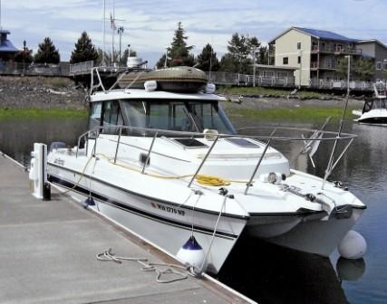
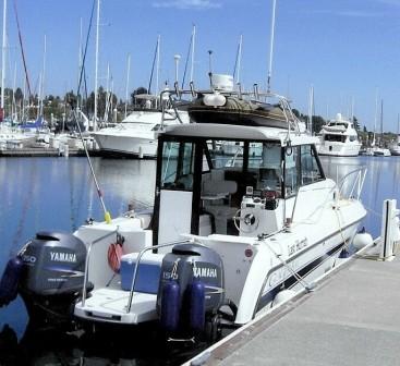
The Last Hurrah in Blaine, WA ready to head north
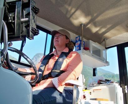
Day 2,
6/29/09 Campbell Rive
|
We made it and we’re back on schedule! The forecast
this morning leaving Gibson’s was iffy again but we decided to have a
look. The first hour or so wasn’t bad but then it got almost as sloppy
as yesterday. We decided to stick it out to at least Powell River then
decide whether to try for Campbell River since the forecast indicated it
should be better in the afternoon.
We hugged the east shore of Texada Island since it was a little calmer.
When we got to the north end of the island, which is across from Powell River
it looked better so we headed for Campbell River. Most of the way we
were able to open her up and let her run. Got here at 3:00 and are
doing our laundry at the moment. We plan to do a little grocery
shopping, send email then head back to the boat to refuel and cook
dinner. If all goes well we hope to be in Port Hardy tomorrow night.
|
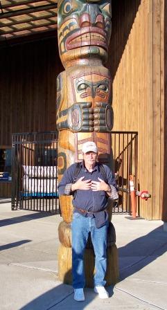
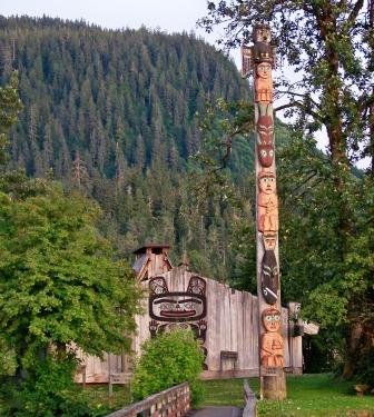
Curt practicing his Totem Pole poses
|
Day 3,
6/30/09 Blind Channel - This morning was bright and sunny with a
light wind in Campbell River. Unfortunately the forecast for Johnstone
Strait was still gale force winds. Johnstone Strait connects to Discovery
Passage where Campbell River is located and is the only way north. There
are several more sheltered channels east of Johnstone that can get you about ½
the way to the north end of Vancouver Island but eventually you’re stuck with
transiting at least part of Johnstone Strait. Since we don’t do gales we
opted for the back channels rather than spend the day in Campbell River.
This turned out to be a great decision since the back
channels were calm, except for the tidal rapids, and the scenery is
spectacular. I was through here about 20 years ago so we had all the
necessary charts. Gorgeous fjords plunging from snow-covered mountains
into the sea which in most places is 1,000 to 2,000 feet deep. We waited on the
worst of the tidal rapids (Yaculta) until the current dropped below 4
knots. The Last Hurrah has plenty of power to push through much higher
currents but eddies and whirlpools in these rapids can get kind of squirrelly
so it’s best not to force the issue.
We headed for a marina in Blind Channel where I had stayed
20 years ago. It’s still there and in great condition. Before we
tied up we stuck our nose out to check Johnstone Strait. Even before we
got close to the Strait the water got very rough so we did a 180 back to the
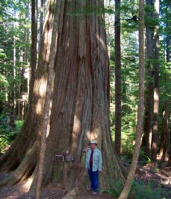
marina. Ken and I hiked up to an ancient cedar tree and got some
great pictures and black fly bites. The trail is maintained by the timber
company who owns the land and who had posted a sign warning we could be eaten
by bears, cougars, wolves etc. Even Canada must have its share of lawyers
with not enough to do.
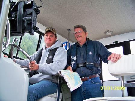
Ken & Curt on the way to Blind Channel
Ancient
Cedar tree
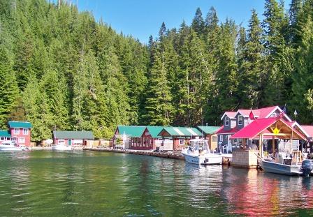
Sullivan Bay - a floating town
Day 4,
7/1/09 Sullivan Bay - We decided to do more back channels rather
than to head up the middle as the forecast for Johnstone Strait was still
pretty glum this morning. Also, Ken decided that it was more important to
him to have a pleasant, scenic cruise than bull our way to Alaska on a
particular schedule. Since he has to get back to work to support us old
folks we felt he should control the schedule. This was a good decision
since we had to do only about 10 miles of the fearsome Johnstone Strait, which
turned out to be not too bad. However the reward was a spectacular cruise
through gorgeous fjords where we saw dolphins, Orcas, waterfalls and rays of
the sun breaking through the overcast to highlight the mountains.
We got up this morning at 4:00 to have the best shot at the
weather and made it to Sullivan Bay in the Broughton’s by noon without any
problems. This is a very nice place. All the buildings are on
floats, the store, restaurant, houses, everything. We could serve as a
dinghy for some of the boats here. There is a helicopter on the roof of
one of the houses and seaplanes coming and going on a regular basis.
Since it was Canada Day, something like our Fourth of July, we were asked to
join in a booze cruise but declined since we were heading out early the next
morning to challenge the infamous Queen Charlotte Sound.
Day 5,
7/2/09 Allison Harbor - The forecast for Queen Charlotte Sound
wasn’t good when we got up at 5:00 but the in-shore portion known as Queen
Charlotte Strait sounded doable and there are several good places to anchor
along the way if it got too rough. After we passed the Storm Islands in
Queen Charlotte Sound we started encountering some big Pacific swells (10
ft). They were not uncomfortable and safe enough but after about ½ hour
they started getting higher and closer together. Since we still had a
good 20 miles to go to get across the Sound and the seas were building we
decided to head for shelter in Allison Harbor. It’s a gorgeous place,
well protected with good anchoring in about 25 feet of water. The only
problem is the entrance has several drying rocks mid-channel and it was very
sloppy and foggy when we came in. Fortunately, the RADAR easily picked up
the breakers over the drying rocks and the Nobeltec Admiral software, which can
superimpose RADAR targets on the chart, worked very well.
There was one other boat here when we came in just before
noon but two more came in after us (a 50’ and a 60’ trawler) so in must be
getting pretty rough outside.
Day 6,
7/3/09 Allison Harbor - Got up at 4:00 to check the weather
forecast for Queen Charlotte Sound and it was worse than yesterday so we went
back to sleep in our snug little cove with eagles fishing around us. They
update the forecast every 4 hours and as the day wore on it got much better
until at 4:00 pm we had go conditions. We only had 25 miles to the next safe
harbor, which we could do easily in 2 hours even in rough water so we went.
Since I’m writing this at 10:00 pm and it’s still quite light there was no
problem with getting stuck in the dark.
The crossing wasn’t bad. Still some big Pacific swells
but the boat rode them comfortably and by 7:00 we were refueled and tied up
snugly at Duncanby’s Landing in Rivers Inlet, about 15 miles north of Queen
Charlotte Sound. From here to Juneau the route is much better protected
from the weather but Mother Nature doesn’t give guarantees so we could get
stuck again. Assuming all goes as planned we will be in Shearwater
tomorrow night.
Unfortunately the kerosene stove has quit working. It
still starts up but doesn’t put out enough heat to boil water. We checked
everything we can to no avail. Shearwater has a substantial boat yard and
maybe they can help us but we get there on a Saturday so who knows. The
microwave works fine and we used it to make two dinners so far. It’s a
pain in the @#$!+&* compared to the stove when it was working but better
than nothing.
Day 7,
7/4/09 Shearwater - This is a working port with a serious (70
ton) boat yard, shop, marine store, grocery, etc. It was a sea plane base
during WW-II. Mooring and gas prices are also much better than at the
“Resort” marinas. We left Duncanby’s at 7:00 for the 60-mile run and made
it here at 10:00. There was a light ripple on the water, just perfect for
the Last Hurrah to skim across the water. About half way here we
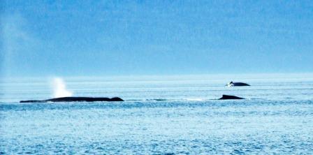
encountered a pair of humpback whales broaching and smacking the water with
their flukes. It was a fantastic sight. We stopped to take some
pictures and of course they dove. We waited for 10 minutes and all we saw
was their backs and spouts as they surfaced to blow. As soon as we
started the engines and got under way they both broached as if to say Nah-Nah-Nah-Nah-Nah
we didn’t let you get any decent photographs.
Passed a big Canadian Coast Guard buoy tender or
maybe an ice breaker as we entered Lama Pass, about 10 miles from
Shearwater. Found a solution to the stove problem. There
was nobody here that works on kerosene stoves but we were able to get a
porpane fired Coleman stove and figure out a safe, secure place to
mount for cooking. Unfortunately we'll have to forgo cabin
heat. So far we haven't needed it but there are always long
john's, etc. if it gets cooler.
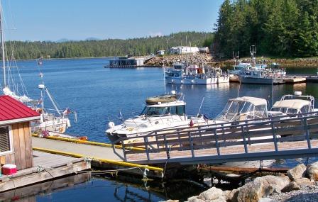
Shearwater Marina
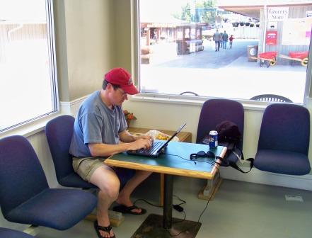
Ken checking email while doing laundry
Day 8,
7/5/09 Hartley Bay – This is really the middle of nowhere,
tomorrow we should reach the north edge of nowhere. Hartley Bay is a small
Native village, about 150 or so very friendly people. They have fuel and
a State marina. The fuel price was good and the marina free. No
store, just a person who sells snacks from their house. They must get
what they need from Prince Rupert via the daily BC ferry and by hunting and
fishing. The man we talked with said there used to be about 220 people
but the younger people are leaving.
The run from Shearwater was fine. Since the water was calm
we took the direct, less sheltered route, which saved about 15 miles. Fog and
overcast for the first hour or so but then the sun burned through and it was
spectacular.
Had a little excitement before dinner while tied to the dock
in Hartley Bay. The access port at the stern of the port hull must have
started leaking during the run from Shearwater. No damage, the bilge
pumps handled it and Ken was able to tighten it up. Seems to be holding
fine but we’ll keep an eye on it and pick up some sealer in Prince Rupert.
Day 9,
7/6/09 Prince Rupert - We woke up this morning in Hartley Bay
floating just fine. Ken’s tightening job must have solved the
problem. The day started out overcast and drizzly but by 7:30 the sun
came through. The route to Prince Rupert is through the Grenville
Channel, a classic fjord only a mile or two wide and 45 miles long with snow
capped mountains rising from the shore and feeding magnificent waterfalls.
Because of its scenic beauty this is a favorite cruise ship route.
The last 10 or so miles to Rupert were foggy, sometimes very
foggy but the radar did fine and we had no problems. Prince Rupert has a
population of about 14,000, is one of the few places up here connected to the
rest of the world by road and the first real town since we left Campbell
River. The preferred marina for cruisers is the Prince Rupert Rowing and
Yacht Club but they were booked up so we put our name on the list, tied up at
the commercial dock next to a bunch of fishing boats, grabbed our backpacks and
went grocery shopping. By the time we were done a space had opened up so
we left Curt at the Yacht Club with the groceries while Ken and I refueled the
boat and moved it to the Yacht Club.
By the time we were done Chef Ken announced that
the menu for tonight was stuffed crust pizza supreme as opposed to
chicken or tuna pasta, canned vegetables and a salad which was our
usual menu (he had seen a Pizza Hut while we were shopping which I
think influenced tonight's menu). The yacht club also has clean
showers for 2 loonies (we paid 10 loonies for a shower at
Duncanby's). For those not familiar with Canadian mones the
"loony" is their $1 coin. It has the immage of a loon on
it. Whenever the Last Hurrah travels in Canadian waters it
carries a Loony Bin (a zip-lock bag full of Canadian coins). So,
when there are hot showers you grab your towell and the Loony Bin and
run. Tonight for only $5.40 I have a much happier and sweeter
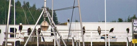
smelling crew. The eagles below were watching the fish cleaning
station.
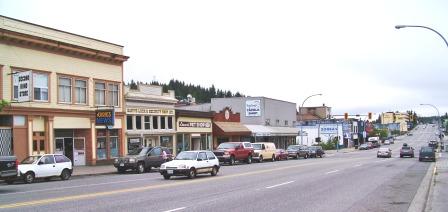
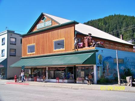
Downtown Prince Rupert
Eagles lined up by the yacht club waiting for dinner
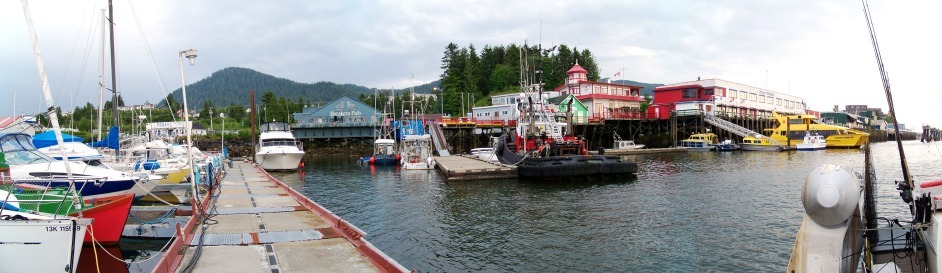
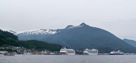
Day 9, 7/7/09 Ketchikan, Alaska - The
run north from Prince Rupert was very easy, light chop, overcast but no
serious fog or rough seas. Got here about 11:00 and checked in
with customs. There were three cruise ships here which almost
obscured the whole town so it was hard to figure out what was
where. Called the Harbor Master on the radio and he directed us
to the "City Float" just in front of the "blue" cruise ship. The
only blue cruise ship we saw was the Statendam that was white with a
blue hull. We snuck under her bows and found a tiney dock.
After we we tied up I took all the passports and the ships papers to
customs, filled out the paperwork and they came down to checkout the
boat and its motley crew. Although we were kind of scruffy
looking they let us in even though we were not at the "City
Float". After checking in we took a walk around town, had a nice
lunch and went back to move and refuel the boat. After refueling
we went back to the dock for the night. Ken did some shopping and
Curt and I assumed the "yachtman position" butt down, feet up and book
in hand.
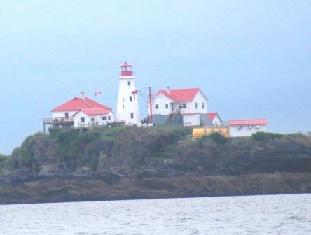
Green Island light
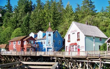
Ketchikan
Creek area in Ketchikan
Day
10, 7/8/09 Petersburg, Alaska
- Today was a 120 mile run but
except for about 45 minutes of fog early on it was perfect – calm
water, sunny
skies, snow capped mountains and lots of whales. Left Ketchikan
about
6:00 and were in Petersburg for lunch. The Coast Guard
buoy-tender
Elderberry was tied up at the USCG Station but my friend is no longer
her CO
and was on temporary duty in Ketchikan. I was told his family is
still
here but they weren’t listed in the Petersburg phone book. I’ll
try again
to contact him when we head south. We are only a day from our
destination but Ken doesn't fly out until Monday afternoon so he plans
to do some sightseeing and Curt and I plan to assume the
"yachtman posityion" till next Tuesday.
Petersburg
Petersburg
entrance buoy full of seals
Humpback in Fredick Sound
Day 11, 7/9/09 Auke Bay, Juneau - We made it from
Blaine to Juneau in 11 days, not too shabby in my opinion. Today
was another gorgeous sunny day with calm waters, light winds and snow
capped mountains. Saw at least a dozen whales near the
intersection of Fredrick Sound and Stevens Passage. This time I
got some video of them on the surface. They were much larger than
the humpbacks we saw on the way to Shearwater and they didn’t broach
but I got some good fluke shots as they sounded. Curt thought the
one group, which came within a 100 yards of the boat, might be fin
whales. There is a big picture display at the marina here we need
to study so we can identify them better.
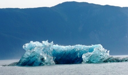
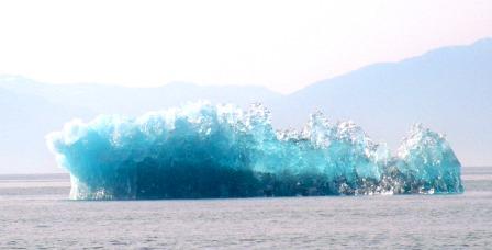
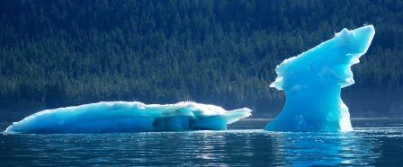
Saw our first icebergs today, at least ½ dozen the size of a small
house and lots of berglets. They came out of Holkum Bay into
Stevens Passage. Holkum Bay has three glaciers feeding it.
We considered going in there but decided to run on to Juneau so Ken can
do some sightseeing before he has to fly out.
Day 12 to 16, 7/10-7/14 /09 Juneau
- Bright sunny, calm weather all 4 days we stayed in Juneau. The
weather will probably turn to crap as soon as we get underway
again. Curt twisted his ankle Friday morning stepping off the
boat. He said it was OK so we hopped on the bus and went
sightseeing. Saturday morning it was very swollen so I took him
to the ER to get it checked out. Nothing broken, his blood work
was fine and they gave him a tetanus shot because he had scrapped his
shin in the process.
I had the oil and plugs changed in the engines. The tech that
changed the oil had a laptop with Yamaha software that could diagnose
the engines. They were both in spec. I called the stove guy
in Seattle. He said “Oh you got 5 years out of the wick, that’s
about normal.” “It will last longer if you only buy kerosene in 1
gallon cans and don’t use kerosene that is more than a year old”.
I asked how you could tell if the kerosene was too old. He said
you couldn’t but if I bring in the stove he will be glad to fix
it. Wow, what great recommendations. I think I’ll order the
parts and fix it myself.
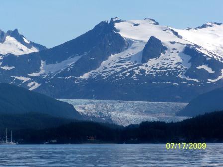
While we were in Juneau Ken hiked to the Mendenhal glacier, which isn’t
far from the city bus route (you can see it from the boat). Ken
flew out Monday afternoon and Curt and I leave for Hoonah early
Wednesday morning. We got a permit to enter Glacier Bay Thursday
and Friday. Hoonah is a native village about 25 miles SE of the
entrance to Glacier Bay.
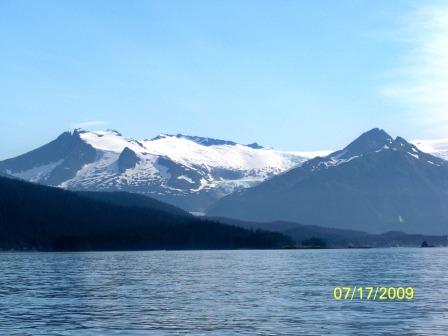
Mountains behind Auke
Bay
Mendenhal
Glacier
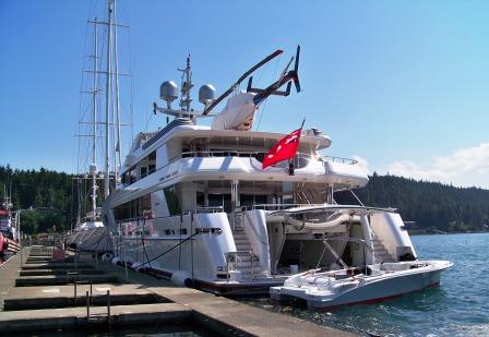
One of our neighbors in Auke Bay
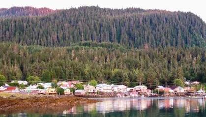
Day 17, 7/15/09 Hoonah
- Left Juneau about 6 am with overcast skies but moderate to calm
seas. About 1/2 hour out I almost hit a humpback whale. The
sucker surfaced less than 50 feet off my starboard bow when I was doing
25 mph. Needless to say I pulled the throttles back quick and did
a hard left. We missed! Since the whale was crossing from
my starboard I guess that gives him the right-of-way according to the
navigation rules (is a whale considered a vessel operating under power
or if he is bigger than you does the law of gross tonnage
control?). Saw another one a half hour later about 100 yards
away. There are lots of whales here as well as eagles and a huge
spotted owl sitting on a rock on the beach. The owl was sunning
himself and had about a 6 foot wingspan.
We got to Hoonah about 9am and were surprised to see a cruise ship
here. Hoonah is a native village /fishing port of less than 1,000
people. It’s a favorite holding spot for cruisers waiting to get
into Glacier Bay. Maybe they are waiting for entrance to Glacier
Bay like us. They put a lot of people ashore and many of them
went kayaking. Curt and I took a short walk and stopped for
breakfast at Mary’s Inn. The first “real” breakfast we had since
leaving the lower 48 and it was wonderful. Have to get ready to
take the Last Hurrah into her namesake – Glacier Bay.
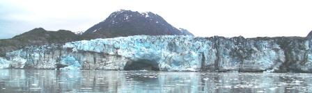
Day 18, 7/16/09 Bartlett Cove, Glacier Bay National Park – Wow, what a
day! Got up at the usual time and were underway from Hoonah by 6
am. The weather was overcast with patches of fog but moderate
seas so we made it to the park office in time for the 8 am
briefing. The briefing consisted of a 20 minute video that was
well done plus a talk with the ranger about boat regulations in the
park, which waters were open to power boats, etc. We then took
off to see what we could see. Saw many more humpback whales, ½
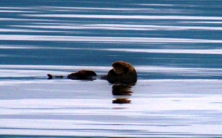
dozen sea otters, Orcas and seals plus lots of ice and glaciers.
It’s hard to find words to describe this place. It’s huge,
spectacular, breathtaking and more. We only saw a handful of
other boats all day. Both Curt and I have been here before on a
large cruise boat but it’s much different from a small boat where you
are down among the sea creatures and the floating ice. I was
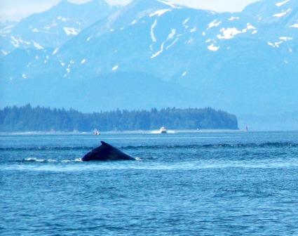
watching two humpbacks off the bow when a mother and calf surfaced
close behind us and their blow was so loud it startled me. We
drifted right up to a sea otter that was snoozing. When he woke
he waved his back feet at us and paddled away. Saw a large salmon
jump followed immediately by a seal looking for lunch.
Took a picture of one of the Princess cruise ships that passed us just
for scale. It looked like a toy when placed next to the
mountains, glaciers and the bay. While it was overcast there was
at least 15 or 20 miles visibility so we could see most of the peaks
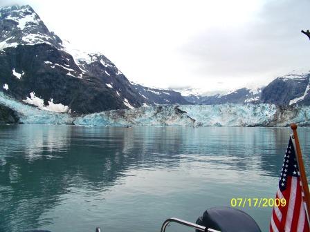
that surround Glacier Bay. We got up close and personal with 2
tidewater glaciers (about a ¼ mile from the face). One had a big
cave with a waterfall inside the cave. There were others we could
have visited but we decided two was enough. In both cases we had
to thread our way through lots of bergs and berglets, which can be
nerve racking. I did avoid hitting the props but took a couple
small berglets through tunnel.
We were both amazed by the number of glaciers in the park. There
are a dozen or more named glaciers on the park map, mostly those that
dump into the sea (tidal glaciers) but many times that number of
hanging glaciers that don’t reach the sea but feed waterfalls and
streams.
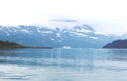
A cruie ship in Glacier Bay
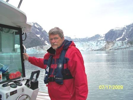
Curt
and me at John Hopkins Glacier
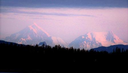
Day 19, 7/17/09 Bartlett Cove, Glacier Bay National Park
- We woke about 4:30am to clear (cold) skies and calm seas. The
clear skies allowed us to see the much taller mountain range to the
west of the park. With the early morning sun illuminating these
snow covered, jagged peaks they were spectacular. I took some
pictures but I doubt they will do them justice. By the way it’s
dark only 5 or 6 hours here.
We took off for Auke Bay, Juneau which is about 70 miles from the
park. Icy Straight was calm but once we turned the corner and
headed north up Chatham Strait it got pretty sloppy. We slowed
down, headed for the windward shore and pushed on. It got better
once we turned south around the north end of Admiralty Is. into Saginaw
Channel since we were running with the wind and swells. Just past
the lighthouse there was a lot of activity in the water, a dozen
spouts, lots of flippers and whale tails in the air like a humpback
wrestling match. It was “bubble net feeding” a unique humpback
cooperative feeding strategy, which we’re told, is quite rare to
witness. Curt and I had read about it and saw pictures but never
thought we would see it in person. Unfortunately it was still too
rough for us to get pictures but it was fascinating to watch.
Apparently if a group (pod, herd?) of humpbacks find a school of
baitfish they sometimes circle them blowing a cylinder of bubbles to
herd the baitfish together then take turns coming up from below for a
mouthful. By now we have encountered well over 50 whales within a
few hundred yards or less of the Last Hurrah but this was
special. To see a dozen of these huge a creature working closely
together to collect dinner was something else. At one point the
feeding group moved within 100 yards or so of us, which was interesting
since any one of them was twice our size.
We also saw quite a few sea otters in Icy Strait, some in rafts (a
circle of otters with their toes together in the middle). I have
no idea what any respectable sea otter would be doing up at that time
in the morning in 45-degree water in the middle of a shipping
channel. It appeared that most of them were snoozing with just
their nose and toes above the surface until they heard us.
Sunrise in
Bartlet Cove
Snoozing sea
otter
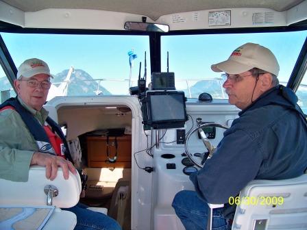
Two old fogies having a great time
Day 20 to 28, 7/18 to 7/25 Juneau
- Curt flew home Wednesday, 7/22 and I had time to relax, clean the
boat and work on the computers. I finally got both computers to
display the AIS signals broadcast by large boats. Julie arrives
Saturday morning so we should be back on the water Saturday afternoon
or for sure Sunday morning.
Most of the week in Juneau it rained but it is clearing up this weekend
so it looks like good weather for the start of the trip home. I
was able to find a small catalytic heater to drive the moisture out of
the cabin. It doesn’t put out as much heat as the kerosene heater
did when it was working but enough to keep the cabin comfortable in
rainy weather.
I met Julie at the airport Saturday morning and we took the bus to Auke
Bay. She had to get up at 4 am to catch the plane to Juneau so we
decided to take it easy the rest of the day. After discussing
what she might want to see on the trip home we decided to head out for
a couple of hours to see if we could find some whales, come back to the
marina in Auke Bay for the night to rest up then start the trip home
Sunday morning.
We went to the spot where Curt and I had seen the humpbacks bubble net
feeding and waited. Sure enough after a short time “there she
blows”. We had a good view of three or four whales for about ½ an
hour then headed back to the marina for dinner and early to bed.
Day 29, 7/26/09 Juneau to Petersburg
- We got up at 5 am and were underway by 6 for the 120-mile run to
Petersburg. It was a bright sunny day in the 70’s, with calm seas
and majestic snow covered mountains on both shores. Lots of
glaciers so I guess no one has told them about Al Gore’s
predictions. In fact some of the glaciers in this area are
growing, not disappearing.
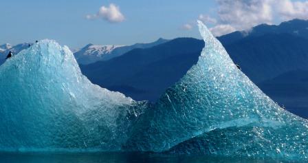
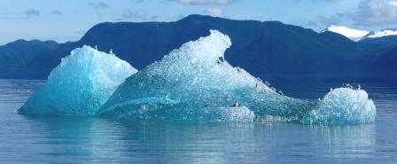
Passed 3 or 4 cruise ships, saw a couple more whales and quite a few
ice bergs – more than when Curt and Ken and I came through here a
couple weeks ago. When we got to the intersection of Stevens
Passage and Fredrick Sound we were back in humpback heaven. This is
where we saw lots of whales on the way up and they were still
there. Julie decided to stop and have lunch with the humpbacks so
I shut down the engines and made sandwiches while she went up on the
bow to take pictures. There were at least ½ dozen whales and some
came within 50 ft of the boat. One swam under us and he looked to
be 8 ft. wide. We were there about an hour with
whales broaching and blowing all around us. They make several
different sounds when they blow. Not sure what it means but it
was awesome or as Julie says “Regal.” They are the leviathans – king of
the sea and they move like they own the seas.
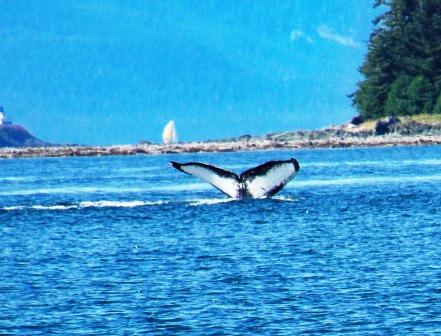
Three humpbacks on
the surface
The hump before the
dive Their tails all have
different patterns
Day 30 7/27/09 Wrangell
- Julie took the boat through Wrangell narrows at low tide, which was
an outstanding learning experience. Wrangell Narrows has more
buoys and day boards per mile than any other place on earth.
Twenty miles of narrow, twisting channels and we met two tugs towing
barges going north that of course stayed right in the center of the
channel.
The run across Sumner Straight from the south end of Wrangell Narrows
to Wrangell was uneventful. Just more spectacular snow capped
mountains and glaciers. It was a gorgeous day but unbelievably
hot - 88 degrees in the shade. We're thinking about stopping at
the Anan Bear Observatory so we walked to the Ranger Station to get a
permit (we needed the exercise). The young lady said they were
booked for tomorrow but there might be a cancelation so we'll call in
the morning before we leave. Wrangell is a neat, clean little
town with very friendly people - we liked it.
Wrangell
from the sea
Tlingit council
house
Downtown Wrangell
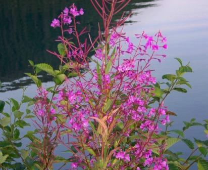
Wild sweet
peas
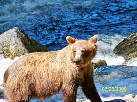
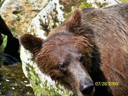
Day 31, 7/28/09 Ketchikan
- Julie got in to the Anan Bear Observatory. I had to stay on the
boat because the anchorage there is kind of iffy. She rowed
ashore in the dinghy and got a ton of great pictures and video of the
bears. It sounds like a reverse zoo with the people inside and
the bears free to come and go, as they like. They come because of
the salmon. The observatory is built around a waterfall and the
Pink salmon were running so there was lots of activity. I’ll let
Julie tell you about what it was like to be in the middle of a grizzly
bear cafeteria at lunchtime.
Good news is I left my two-granola bar lunch in the bear box at the
trailhead and returned with all my appendages attached. At the
trailhead the forest service ranger gave me the run down about staying
on the trail and when (not if) I come across a bear just stand quietly
and hold your ground. She repeated even if they charge hold your
ground and don’t forget to talk to yourself, sing and clap your hands
on the way. I’m convinced this really does nothing to ward off
the bears, instead I will see myself next week on some home video show
singing row, row, row your boat in the middle of a rain forest. She
reminded me that the bears are people habituated. I can definitely say
the reverse is not true. I am in awe of these amazing creatures
after seeing them from 8 feet away. This was all sounding a bit
ominous, but up I went and as I walked away I heard the ranger radio
ahead saying one on her way to the wild side, man isn’t that the truth!
Ten or so minutes down the trail I came across a large scat pile, hmmm
doesn’t look fresh – just keep singing. Two choruses later there
it was a really fresh pile and paw prints to match. My eyes
slowly followed the paw prints and their Yogi was not 10 feet off the
laying face down in the tall grass. He didn’t stir and I was
determined to keep on moving.
I arrived at the observatory in time to have the ranger give me the
hand signal to keep moving quickly but quietly. As I stepped onto
the deck I looked up to see a bear (1 year from the size of him) up in
a tree at least 45 feet off the ground. Just as I pulled out my
camera he stood up on a limb that wasn’t more than 3 inches wide and
began to vigorously scratch his backside against the trunk.
Mental note, never climb a tree when evading a bear – they will kick
(and evidently scratch) your butt with their dexterity.
I remained for another 45 minutes shooting photos all the while
calculating which would happen first the camera battery dies or the
tide washes the dingy out to sea leaving me really at the bear
cafeteria.
The run from the Bear Observatory to Ketchikan was good for the first
half and sloppy but safe for the rest. With the longer route, the
stop at the observatory and the sloppy water it took most of the day to
get from Wrangell to Ketchikan. We got a slip in the Thomas pool
that is right downtown. It was still hot and sunny so the local
kids were jumping off the bridge. Julie thought that looked like
fun so she gave me her glasses, wallet, etc and in she went. The
kids thought that was just great and cheered her on.
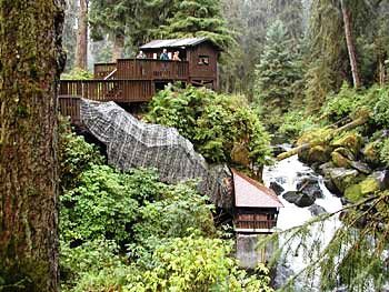
Bear country
Annan Bear
Observatory
Adult Grizzley not long out of hibernation
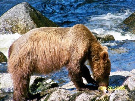
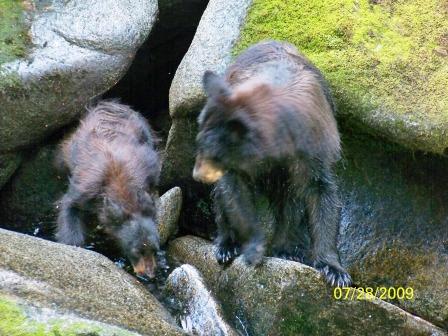
Lunch time
Who you looking
at?
Mom, show me
again how to do this
Day 32 7/29/09 Prince Rupert
- Got up at 5 am in Ketchikan and were underway for Prince Rupert by
6. Sunny sky and light seas until we got to Dixon Entrance where
we picked up some long Pacific swells on our starboard beam/quarter and
patches of fog. Slowed us down some but we still got here before
noon.
I am really getting to love the AIS. It gives you instant
information on all the big ships in your area, sometimes more than a
dozen. The range of the AIS is the same as your VHF radio that
for Last Hurrah is further than its RADAR. The navigation
software puts a boat symbol on both the RADAR and the Chart Plotter for
each AIS target. The symbol has a line extending from its pointy
end indicating its course and speed. If you click on the symbol
it gives you much more information including the closest point of
approach.
Day 33 7/30/09 – Bishops Bay
- Woke up at 5 am in Prince Rupert and couldn’t see the boat behind us
in the marina so we decided to go back to sleep. About 8 am it
looked more promising so we had breakfast and got underway. We
still encountered several patches of pea soup on the way out of Prince
Rupert but by the time we entered Grenville Channel it had cleared
up. Julie considered this good training for running on
instruments only.
The run to Hartley Bay was uneventful except for the MAYDAY call.
We received a real DSC MAYDAY from a boat that had run on the rocks in
Otter Channel. I’m a member of the Coast Guard Auxiliary, have
heard and responded to MAYDAYs before but had never heard a DSC
emergency call. The VHF radio went off like a siren until I
pressed the transmit button. I talked to the Canadian Coast
Guard, told them what I had received and my position. They said
that two other boats were closer so we could go on our way. When
you push that little red button on a DSC radio there is no doubt you
will wake up anyone who receives the signal. Just hope they know
what it means.
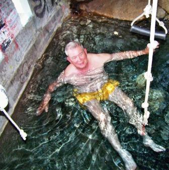
After refueling at Hartley Bay Julie decided it would be interesting to
overnight at the Bishops Bay hot springs which she found in the
cruising guide so off we went. These natural hot springs are
luxurious. After a scrub and soak we sat on the deck to dry while
gazing at the sea and mountains and watching the eagles fish.
Julie on the way to Bishop's
Bay
Me soaking in the hot spring
The deck at the hot spring
Day 34 7/31/09 – Shearwater
- Left Bishops Bay at 6 am with sunny skies and calm water and got to
Shearwater about noon. The first 2/3 of the trip was perfect but
once we entered the Finlayson Channel we hit fog. It varied from
almost pea soup to ½ mile visibility. Passed a couple boats in
the fog but the AIS and RADAR picked them up easily. Also the
automatic foghorn and listen-back features of the VHF radio added a bit
of comfort. Unfortunately, we never heard a sound signal from any
of the boats we passed. Well, so much for following the
navigation rules.
We could see the fog in the Finlayson Channel as we passed Hiekish
Narrows so we decided to continue south in the Tolmie Channel past the
native village of Klemtu before entering Finlayson Channel. This was
exactly the same place we hit fog on the way north. Must be
something about Finlayson Channel or Milbank Sound (where Finlayson
ends) that sets up just the right conditions. As soon as we moved
from Milbank Sound into the Seaforth Channel the fog was gone.
Running in the fog is definitely more tiring than running in clear,
calm conditions. Fortunately Shearwater is bright and sunny with
a light breeze and 87 degrees in the shade. What more could you ask for?
Assuming the weather is favorable tomorrow morning we head across Queen
Charlotte Sound. The plan is to go back the way we came past the
Broughtons and around the east channels to Desolation Sound and
Campbell River. This is much more scenic and sheltered although
longer than the direct route to Port Hardy and on down Johnstone Strait
to Campbell River.
As of 15:00 Friday the weather forecast sounds favorable (West Sea
Otter ocean buoy is reporting 1.1 meters which is definitely a
go). Assuming we still have a good weather report when we get up
we should be in the Broughtons at Sullivan Bay Marina by about noon
tomorrow and Campbell River sometime Monday.
Day 35 8/1/09 – Millbrook Cove, Smith Sound
- I sure missed my prediction of a chance to cross Queen Charlotte
Sound this morning. Maybe I should have been a weather
forecaster. Got up at 5 am to check the weather and it was pea
soup plus the forecast for Queen Charlotte was worse than yesterday
afternoon when we got to Shearwater. West Sea Otter had gone up
from 1.1 meters to 1.6, which is right at the go/no go line for
us. Since Shearwater is about 30 miles north of Queen Charlotte
Sound we decided to wait out the fog then head down to Smith Sound for
a look-see.
The fog lifted by 9 so we headed south to take a look at Queen
Charlotte Sound for ourselves. We met a couple more humpback
whales on the way. By the time we got to Egg Island Light (the
north edge of Queen Charlotte Sound) we had seen enough so we headed
into Smith Sound and dropped anchor in Millbrook Cove to wait for
better crossing conditions. This cove is very snug with good
holding although a bit tricky to get into. There were three boats
when we got here and two more came in later. We had a very calm, quite
night.
Day 36 8/2/09 – Still in Millbrook Cove, Smith Sound
- The 4 am weather forecast was again marginal with West Sea Otter at
1.4 meters (better) but the wind at 19 kts (worse) and gale warnings in
effect for Queen Charlotte Sound. We decided to stick our nose
out so we weighed anchor and headed for Egg Island. When we got
there it was pretty sloppy and with a gale warning in effect it was
only likely to get worse so we decided to go back to Millbrook Cove and
wait.
On the way back we met the 47’ Bayliner pilothouse that was anchored
with us last night heading out. Since we saw him fueling in
Shearwater yesterday I assume he is also was headed south. The
rest of the boats are still here. It’s really tough to sit in
this beautiful cove watching the eagles watch us but someone has to do
it. On the positive a Canadian Forest Service boat came into the
Cove to see if anyone was here. They had very nice 30 ft RIB with
a closed cabin, very substantial towing gear and twin 225 HP
Yamahas. Nice to know someone is checking on us.
Day 37 8/3/09 – Duncanby’s Marina, Rivers Inlet
- When I checked the 4 am weather forecast it was worse than when we
went to bed so we decided to backtrack 15 miles to Duncanby’s so we
could send email to family and friends to let them know we were OK,
just stuck on the north side of Queen Charlotte Sound for several
days. Julie also has a theory that Duncanby’s, with its $10
showers is kind of like a toll gate. Unless you give them $10 you
can’t cross Queen Charlotte Sound. Although it had only been 3
days since my last shower I deferred to her wisdom and forked over my
$10. Low and behold only 4 hours after my shower the weather
forecast started looking better. If this keeps up we may make it
across tomorrow.
Day 38 8/4/09 – Campbell River
- Julie was right. Pay the $10 shower toll and you can cross
Queen Charlotte Sound. We went all the way from Duncanby’s in
Rivers Inlet to Campbell River, a little more than 160 miles in 9 hours
including a ½ hour or more stop just south of Robson Bite to watch a
pod of Orcas put on a show. All this and we still had 75 gallong
of fuel in reserve.
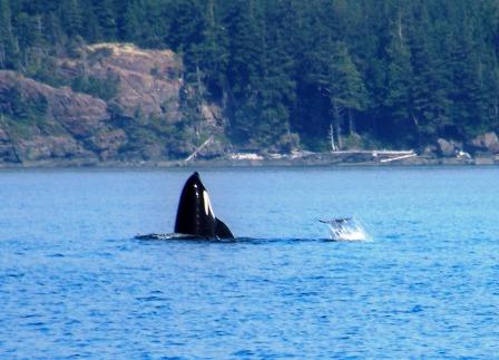
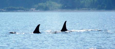
An orca
"spy hopping"
An orcaa pod passing by
The crossing was kind of like a 2 hour sleigh ride. There was a 2
to 3 meter long ocean swell out of the NW. It was on our
starboard quarter most of the time but occasionally on our stern, which
made it more interesting. At those times our speed over ground
(SOG) went from ~10 mph as we climbed up to ~30 mph as we surfed down
without touching the throttles.
We arrived at Seymour Narrows (just north of Campbell River) at exactly
the wrong time, about 1 hour before maximum current. The computer
said we had a 12 kt current on our stern. We saw a couple small
boats go through so rather than wait 4 hours for it to drop to 6 kts or
less we gave it a shot. This time it was more like a slalom
course than a sleigh ride. There were lots of impressive
whirlpools and over falls. The key seems to be to run it at about
½ throttle threading your way around the worst water while keeping
plenty of power in reserve to bull your way through the really
squirrelly water you can’t avoid. Over all it was a very good day
and Julie got some great photos and video of the Orcas.
Day 39 8/5/09 – Ganges Marina, Salt Spring Is., BC
- Since the weather forecast looked kind of OK we decided to make the
run from Campbell River to somewhere near Blaine on the west side of
the Strait of Georgia which is less protected than the east side.
The first 1/3 from Campbell River to just north of Comax was fine but
by the time we reached Comax it was getting pretty sloppy forcing us to
slow to 10 to 15 mph so we decided to run inside the islands south of
Comax. That was fine until we ran out of islands and got hammered
again. The next segment from Chrome Island to Nanaimo was slow
and sloppy but the Last Hurrah handled it well with sometimes green
water over her windshield.
Once inside at Nanaimo it was great for the next hour or so then it got
sloppy again but not too bad. I must say our timing of tidal rips
hasn’t been good on the southbound trip. We hit Seymour narrows
with 12 kts on the stern and Dodd narrows with 8 or 9 kts on the
bow. While Dodd narrows is much smaller than Seymour narrows Dodd
is very much tighter. The over falls were much higher and the
whirlpools much deeper. Before entering I was sitting there
looking UP at the water coming at us. It was steeper than
anything I had encountered in Hells Canyon with the old Sea
Gypsy. My guess is somewhere between 3 and 5 feet difference in
elevation between the upstream and downstream sides.
We watched an open boat smaller than us come down safely so I decided
to go for it – straight up through the middle. Thank you Yamaha
for 300 reliable horsepower. We bulled our way through with no
problem but I have to say it felt weird running at 4000 rpm and doing
about 15 mph instead of 25 mph.
Day 40 8/6/09 – Blaine, WA
- Got up at 5am to check the weather and it sounded good so we headed
east out through Active Pass to Point Roberts, the US Customs check-in
point. The run from Ganges to Point Roberts is only 25 miles so
we were sitting at the customs dock before they opened. I won’t
waste time describing the run around we got from US customs at Point
Roberts but suffice it to say @#$%#&*. Once they showed up at
the boat they were fine and we had no problems getting back into the
US. The problem is their stupid phone system and crazy
bureaucracy related to who answers the phone first. Unbelievable!
After checking in with Customs, (a WSU grad where Julie also graduated,
that had friends in the Tri-Cities where I live) we were off to Blaine
to haul out and clean up. By noon we were respectable looking
(Julie did a great job of cleaning the boat inside and out) and packed
up so we headed south by car. Julie had other commitments on the
west side this weekend so I left her with her with a friend at Mt.
Vernon and headed off to Ellensburg via Stephens pass.
Day 41 8/7/09 – HOME
- Well, the Great Adventure is over and it was truly great. I’m
too old to do it again but I must say it met all my expectations.
Thanks to everyone who made it possible, my brother Curt and his son
Ken who crewed and shared expenses on the northbound trip, my daughter
Julie who helped me bring the Last Hurrah back home, my friend Don who
had done the Inside Passage for his advice and the loan of charts and a
cruising atlas which proved invaluable and most of all to my wife who
encouraged me to pursue my dream.
Here again is the link to the videos we took which are posted on YouTube. Views of Alaska from a small boat